OfflineMaps provides you with access to a vast array of maps, ensuring a seamless and private navigation experience.
No advertisements ~ No data sharing & monetization ~ No analytics ~ No third party libraries
Tired of waiting for maps to load? With All-In-One OfflineMaps, once a map is displayed, it's stored and remains accessible instantly, even without an internet connection.
• Looking for more than just road maps? You'll find everything you need right here;
• Frequently visit areas with poor network coverage? No worries, all your maps will stay available;
• Traveling abroad? You'll never feel lost again;
• Concerned about data limits? This will help reduce your data usage significantly.
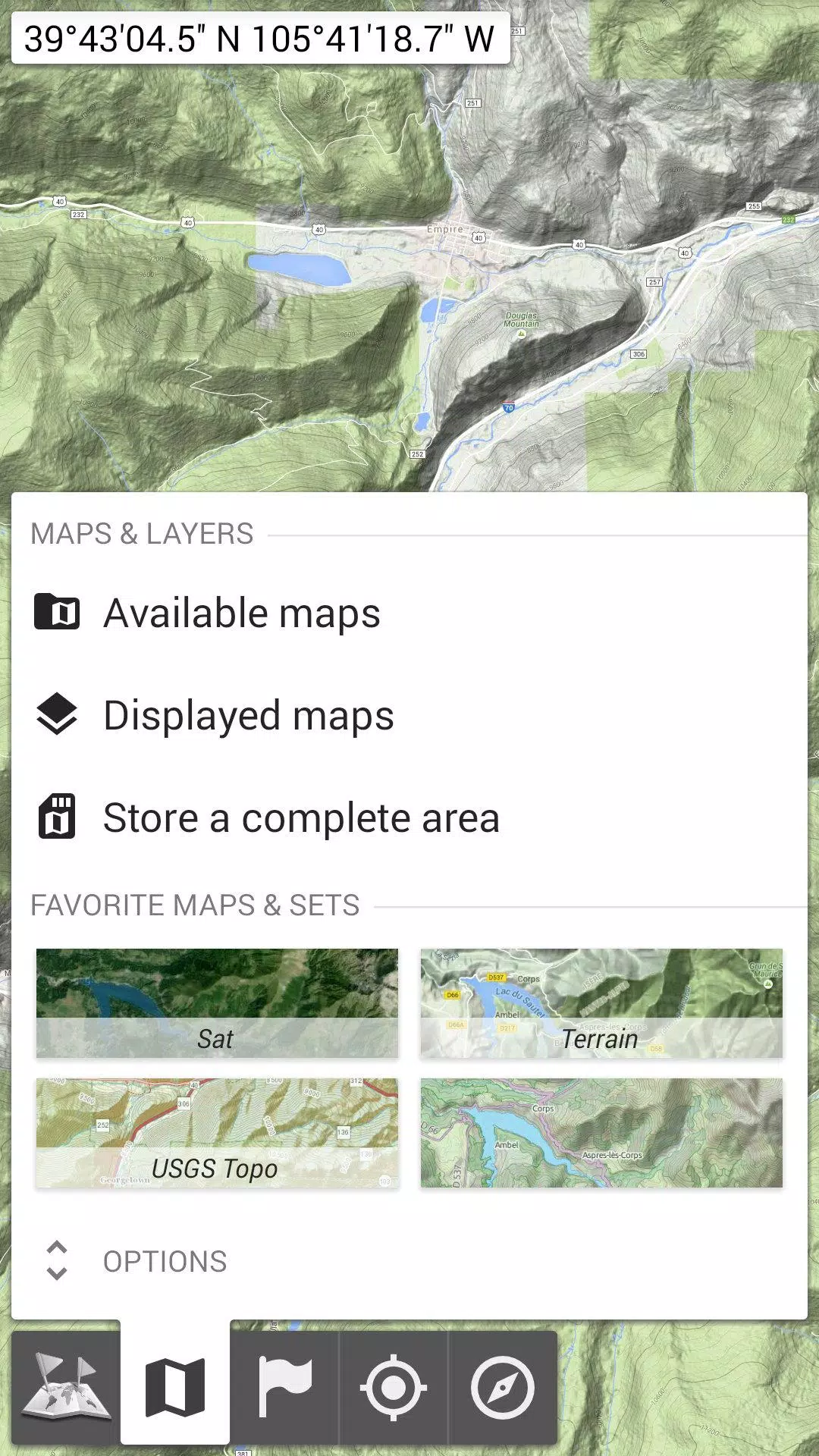
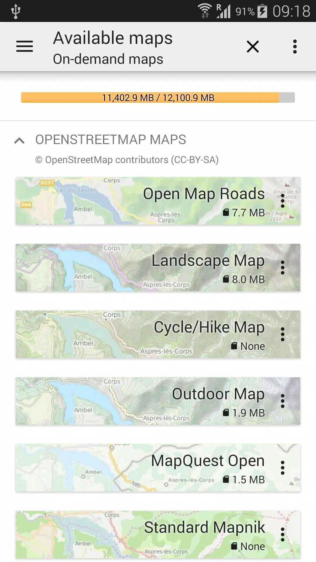
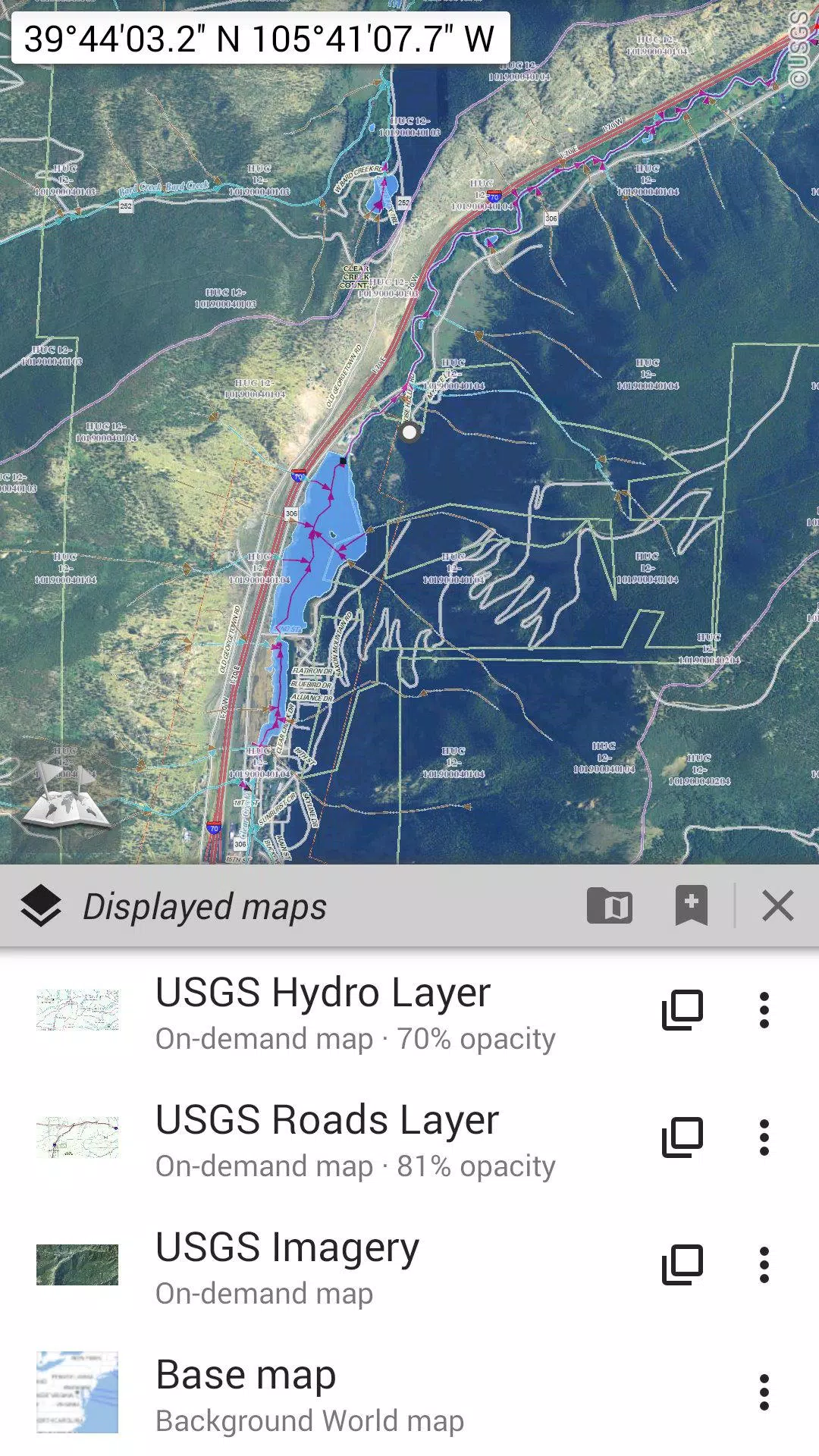
★★ Maps ★★
Explore a variety of maps, from traditional road maps and topographic maps to aerial (satellite) maps and additional layers that can be overlaid on any map: OpenStreetMap (Roads, Topo), USGS National Map (Hi-res topo, Aerial imagery), Worldwide Military Soviet topo maps, and more.
• Layer maps with precise opacity control;
• Easily select and store large areas with just a few clicks;
• Manage your stored space effortlessly, with the option to delete as needed.
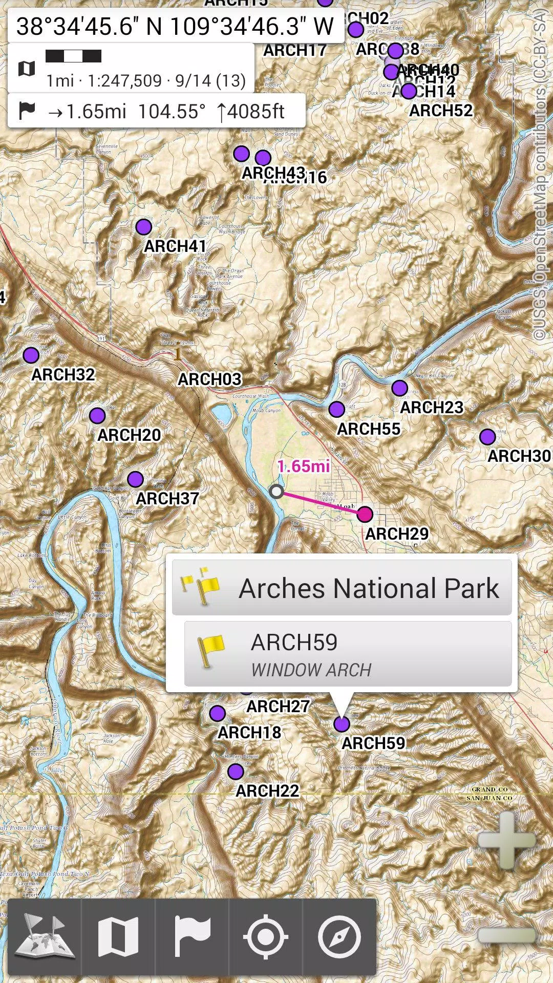
★★ Display, Store, and Retrieve Unlimited Placemarks ★★
Enhance your maps by adding various items such as waypoints, icons, routes, areas, and tracks.
Effortlessly manage these items using the powerful SD-Card Placemarks Explorer.
★★ On-Map GPS Location & Orientation ★★
See your real-time location and direction clearly displayed on the map, which can be rotated to align with your actual orientation (based on device capabilities).
Turn GPS on and off easily to conserve battery life.
Additional features include:
• Metric, imperial, and hybrid distance units;
• GPS Latitude/Longitude and various grid coordinate formats (UTM, MGRS, USNG, OSGB Grid, Irish Grid, Swiss Grid, Lambert Grids, DFCI Grid, QTH Maidenhead Locator System, etc.);
• Import capability for hundreds of coordinate formats from https://www.spatialreference.org;
• On-map grid display;
• Full-screen map view;
• Multi-touch zoom;
• And more.
★★ Need More? ★★
For the avid adventurer, try AlpineQuest Off-Road Explorer, the comprehensive outdoor solution built on All-In-One OfflineMaps, featuring a robust GPS Track Recorder and additional tools: https://www.alpinequest.net/google-play