Catch them all! The only application with offline maps for collecting mountains.
Supported locations:
Czech Republic, Slovak Republic, Austria, Switzerland, Slovenia, Faroe Islands, Italy - Sardinia Sicily, Portugal - Madeira
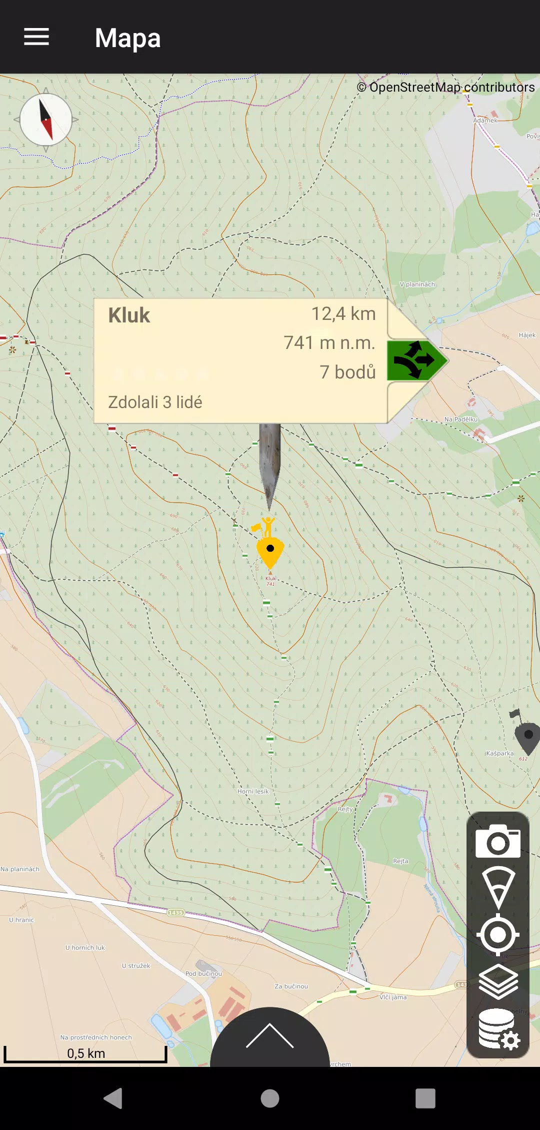
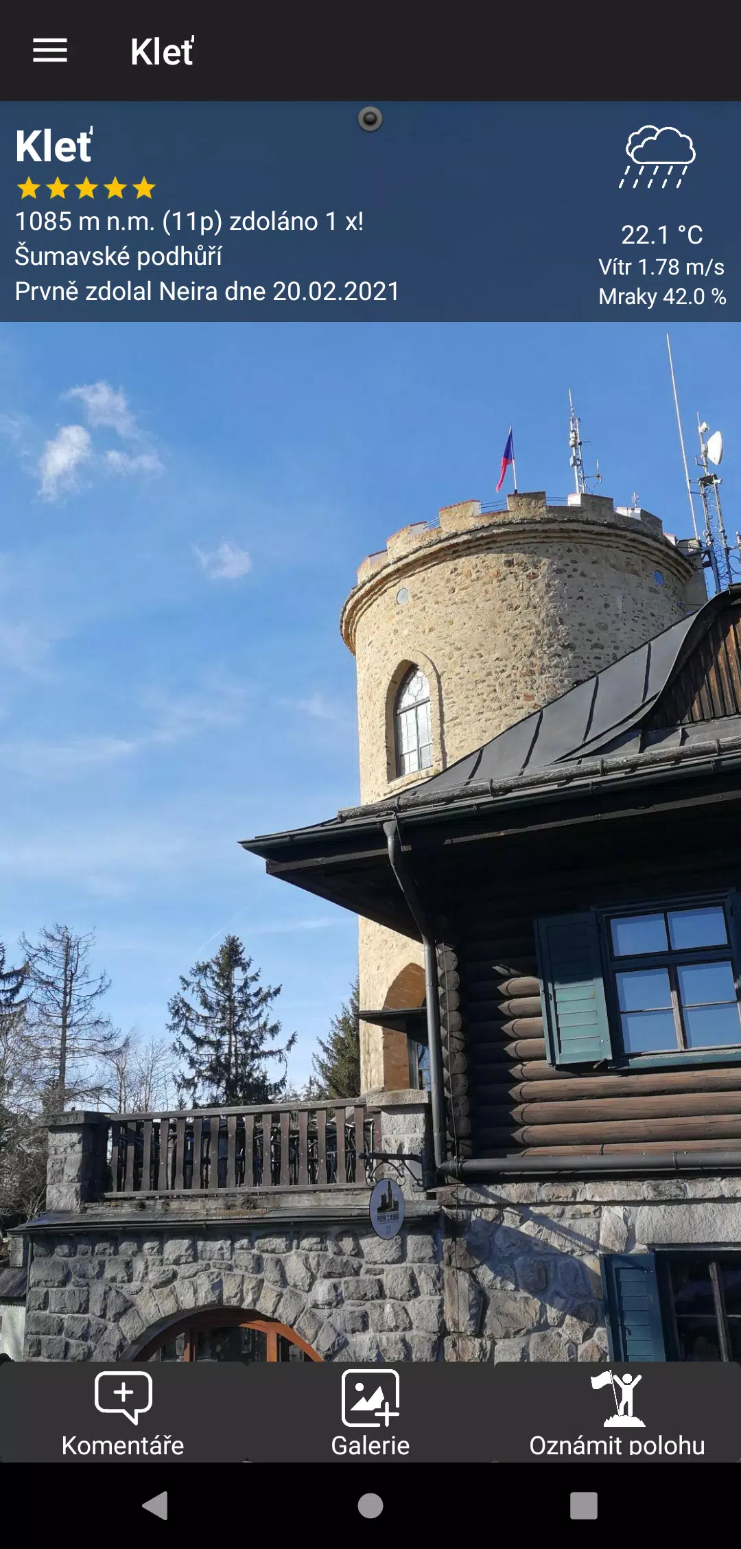
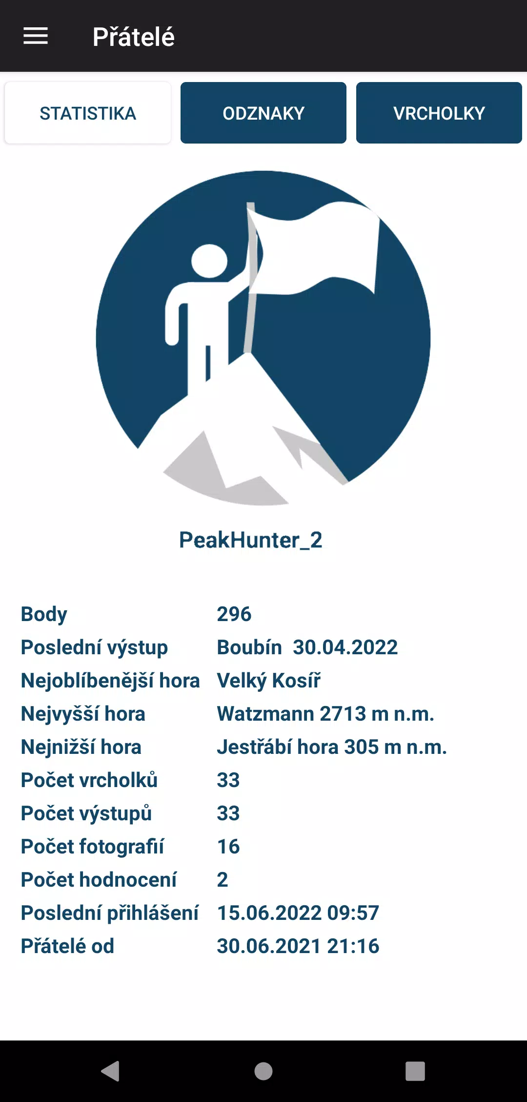
The Peak Hunters application is your go-to tool for mountain enthusiasts, featuring a continually expanding database of peaks from the Czech Republic and surrounding countries. Utilizing your mobile phone's GPS, you can log your ascents and earn a point rating that reflects the mountain's altitude and the difficulty of the climb. Add your personal ratings and photos to each peak you conquer, making your journey uniquely yours. The app displays all peaks clearly on the map, allowing you to filter them by country, mountain range, or proximity to your current location.
For those venturing into areas with weak signals, Peak Hunters allows you to download offline map data. These maps, powered by OpenStreetMaps, include tourist routes to guide your exploration. If you come across a peak or plan to visit a hill not yet in our database, simply long-press on the map to submit it. Once approved, the peak will appear in the app, and you'll earn bonus points for your contribution. The application also boasts a growing collection of statistics and collectible badges. Keep track of your achievements, and receive special congratulations for rare badges.
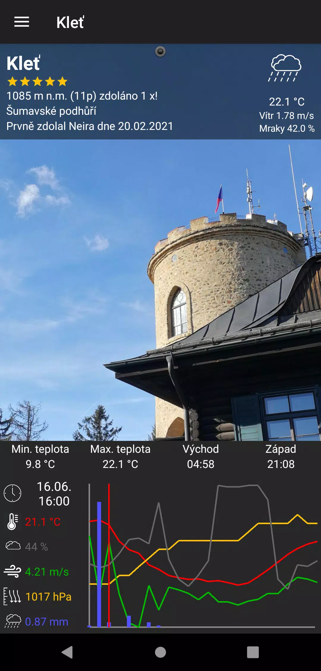
Stay prepared with real-time weather forecasts for each peak, aiding in your trip planning with forecasts up to 48 hours in advance. Another standout feature is the ability to identify mountain tops by simply pointing your phone at them, with the correct distance filter set.
Peak Hunters also supports an anonymous mode, allowing you to use the app without registering. In incognito mode, while you can't transfer your profile to other devices, log out, or recover it if your device is lost or data is damaged, it's a great way to try the app before committing to a registered profile.
The application is completely ad-free and incurs no fees. It was created by a passionate hiker seeking a tool to collect peak data during travels, complete with the option to download offline maps. Users can now manually switch between dark and light modes from the user profile screen. If you encounter any issues or have suggestions, feel free to reach out via the in-app form. We value your feedback and continuously strive to enhance your experience. Note that there is no accompanying website; the app is fully functional on its own.
What's New in the Latest Version 1.8.3
Last updated on Oct 20, 2024
Minor bug fixes and improvements. Install or update to the newest version to check it out!