Embark on your next adventure with our comprehensive guide to hiking, cycling, skiing, and exploring the Alps, whether by car or public transport. Our app is designed to enhance your outdoor experiences and ensure you make the most of your journey.
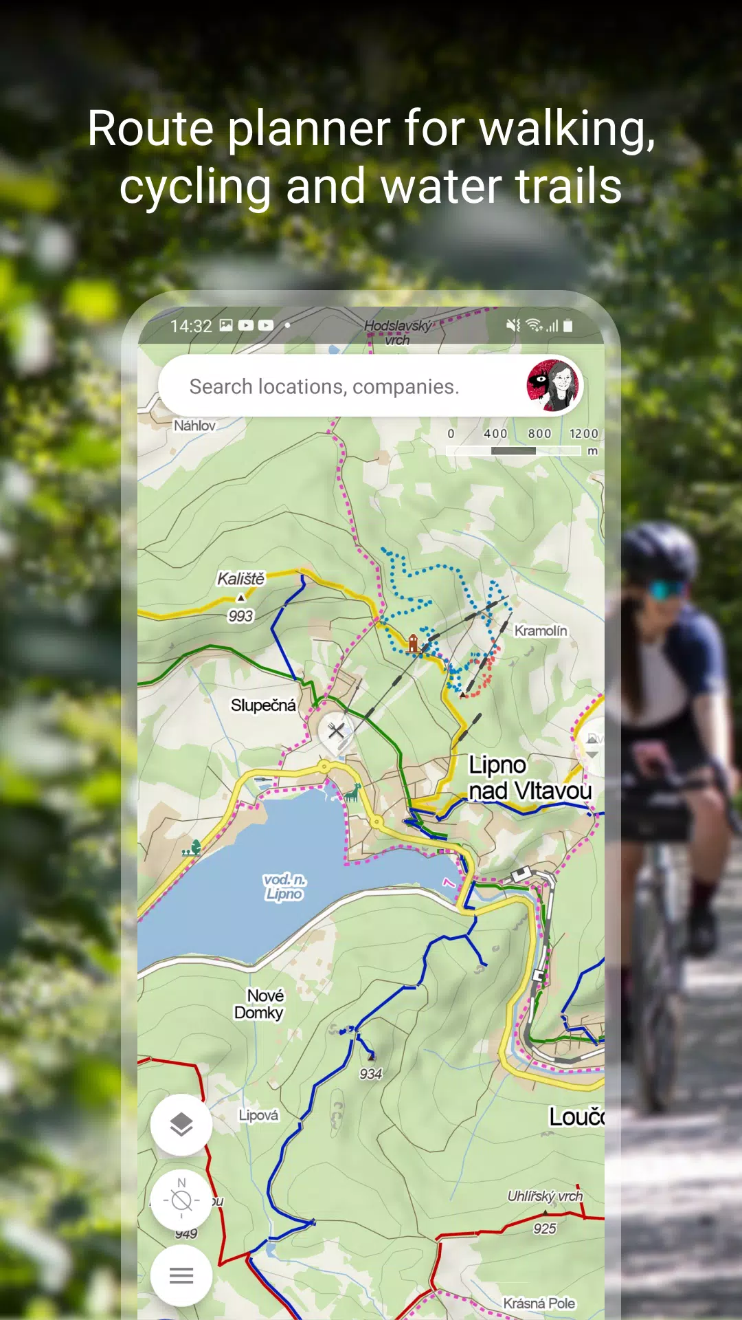
Plan Your Route
Effortlessly plan your next adventure with detailed resources at your fingertips:
- Hiking and Cycling Trails: Discover a wide array of trails suitable for all levels of adventurers.
- Cross-Country Skiing and Ski-Alpine Trails: Navigate through winter landscapes with ease, finding the perfect trail for your skiing adventure.
- Unique "Travel Tips" Feature: Let our app curate a journey through the most scenic and interesting locales in your chosen area.
- Route Elevation Profile: Get a detailed view of your route’s elevation to plan your energy levels and rest stops accordingly.
- 5-Day Weather Forecasts: Stay ahead of the weather with accurate forecasts for temperature, wind, and precipitation for any location on Earth.
Browse the Tourist Map of the Whole World
Explore the world with our detailed tourist maps:
- Trails and Paths: From hiking trails and bike paths to singletracks and footpaths, our maps cover it all.
- Road and Path Markings: Easily distinguish between roads, mixed cycle paths, unpaved paths, and more.
- Hillshade and Ferrata: Navigate with confidence using hillshade features and detailed markings of ferrata routes including their difficulty levels.
- Specialized Zones: Find educational trails, pedestrian closures, national park zones, and routes tailored for wheelchair users.
Switch to Other Map Layers
Enhance your exploration with various map layers:
- Aerial and Panoramic Views: Get an aerial view of the world or explore panoramic images of Czech streets and 3D views.
- Winter Maps: Stay updated on cross-country ski trails and ski resorts with our specialized winter maps.
- Traffic Maps: Navigate the Czech Republic with real-time traffic updates, closures, and parking zones.
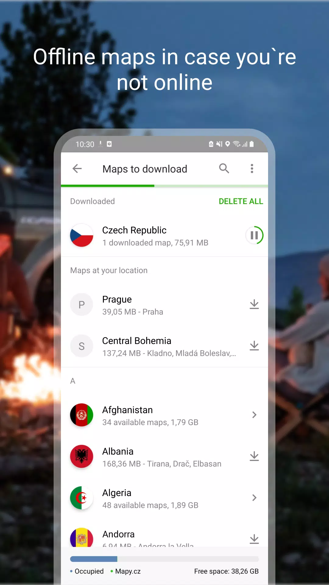
Download Offline Maps
Stay prepared even without an internet connection:
- Offline Tourist Maps: Download maps of the entire world, complete with hiking and cycling trails.
- Offline Voice Navigation: Get voice-guided directions for drivers, cyclists, and pedestrians, even offline.
- Offline Winter Maps: Access detailed winter maps of the Czech Republic, including cross-country skiing trails and ski resorts.
- Region-Specific Downloads: Download individual regions for focused navigation and exploration.
- Offline Search and Planning: Search for places and plan routes worldwide, even without a signal.
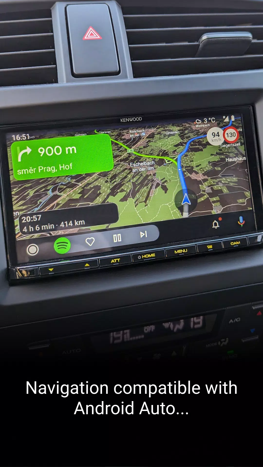
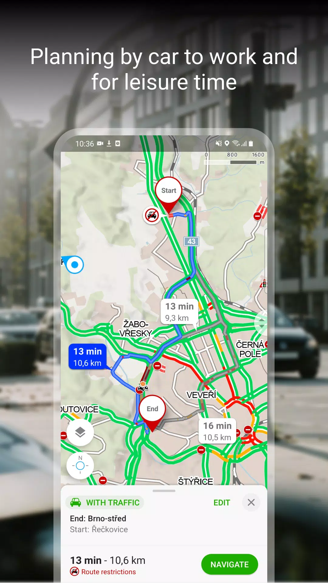
Free Navigation for Drivers, Cyclists, and Pedestrians
Navigate with ease and confidence:
- Clear Lane Instructions: Know exactly which lane to be in with our clear navigation instructions.
- Roundabout Guidance: Easily navigate roundabouts with highlighted exits.
- Toll Lane Avoidance: Opt to avoid toll lanes for a smoother journey.
- Dark Mode: Enjoy navigation in dark mode for better visibility at night.
- Share Your Journey: Share your estimated arrival time, route, and current location via SMS, email, or chat.
- Large Display Compatibility: View navigation on your car's large display through Android Auto or Apple CarPlay.
- Safety Alerts: Stay informed with speeding alerts and speed camera notifications in the Czech Republic.
- Real-Time Traffic Updates: Get the latest traffic situation in the Czech Republic, including traffic jams and alternative routes.
- Safety Warnings: Be aware of sections with frequent traffic accidents and areas without winter maintenance.
Save to My Maps
Organize and track your adventures:
- Save and Organize: Keep places, routes, photos, and activities neatly organized in folders.
- Activity Tracking: Use our Tracker to monitor your activities like walking, cycling, running, cross-country skiing, and hiking.
- GPX Compatibility: Upload, import, and export GPX files for seamless route sharing and planning.
- Cross-Device Synchronization: Sync your planned routes across all your devices for a consistent experience.
Choose by Reviews of Places, Restaurants, and Services
Make informed decisions with user-generated content:
- Up-to-Date Photos: See what places look like through recent user photos.
- User Experiences: Read about others' experiences with food, service, ambiance, and pricing.
- Search by Rating: Find top-rated establishments by searching based on user ratings.
Recommendations and Tips:
To ensure the best experience with our app:
- An internet connection is required to download maps.
- Enable location services on your device for the app to function properly.
- For location sharing, the app needs access to background location data.
- Use the in-app form for any questions or troubleshooting needs.
- Be aware that using the app in the background with GPS can drain your battery.
- Join our user community at www.facebook.com/Mapy.cz/ to share your experiences, stay updated, and suggest new features.