City routes, live traffic, transit routes, parking, offline map and navigation.
We are excited to announce that we have updated 2GIS to enhance its capabilities and user experience. The new version of the app features a refreshed design, an improved search function, and better city updates. We have also integrated favorites with 2gis.ru for a seamless experience.
Services, addresses, and companies
2GIS provides comprehensive information about services in your area. It knows which utility provider services your home, the location of your local hospital or post office, and can help you select a cafe or service center based on reviews and photos. The app also displays opening hours and contact numbers for businesses.
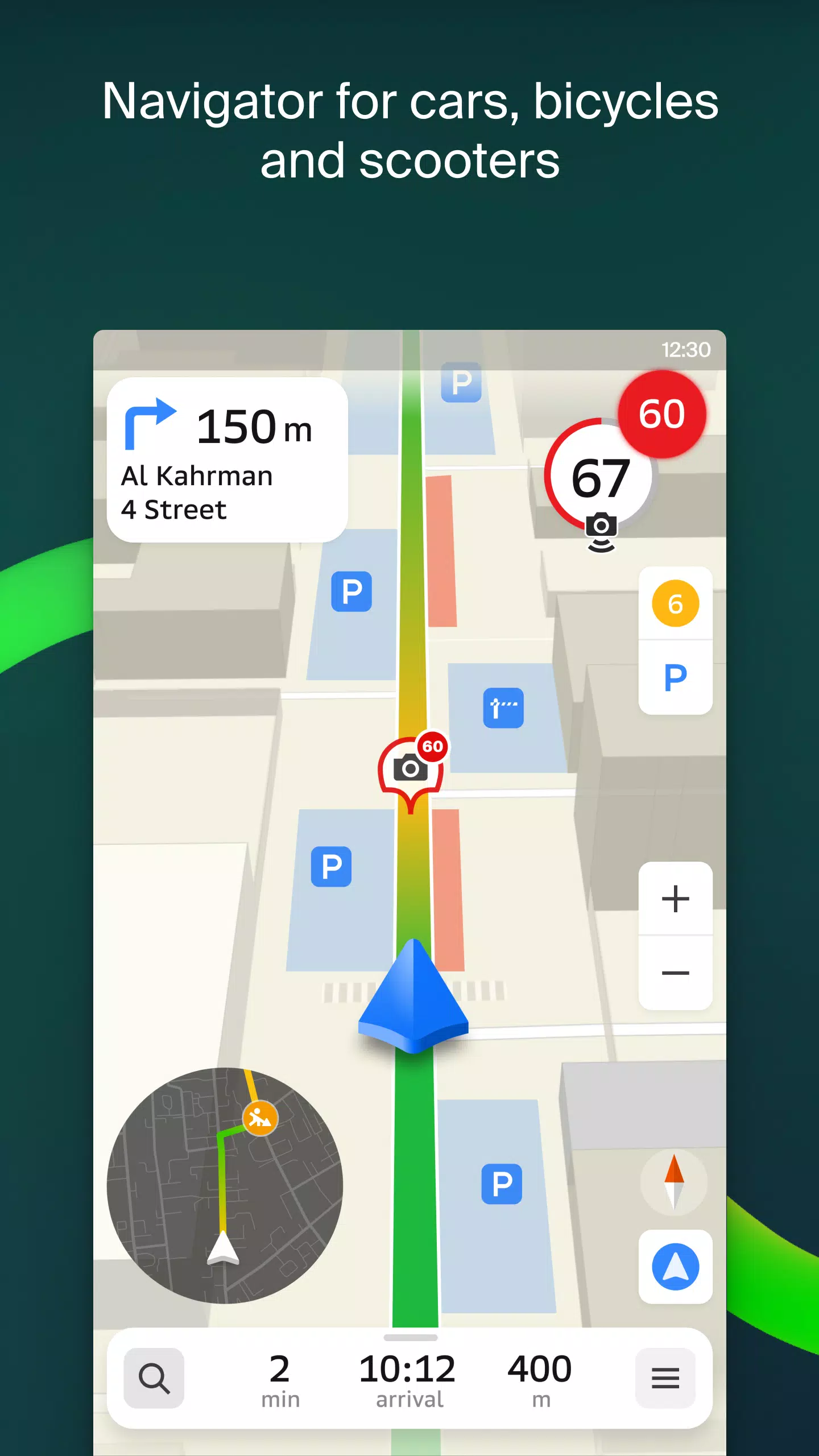
Transport and navigation
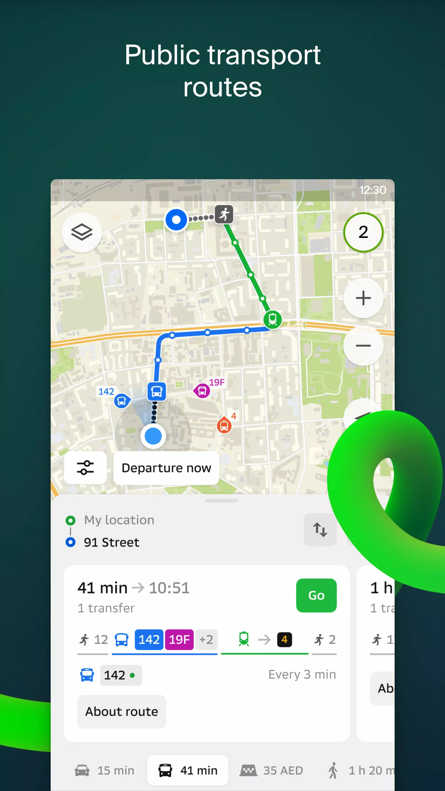
For drivers, 2GIS offers real-time navigation with voice instructions, taking into account traffic conditions and road closures. It dynamically updates your route if you deviate from the planned path. For pedestrians, the app suggests routes using buses, metro, trains, cable cars, and river trams.
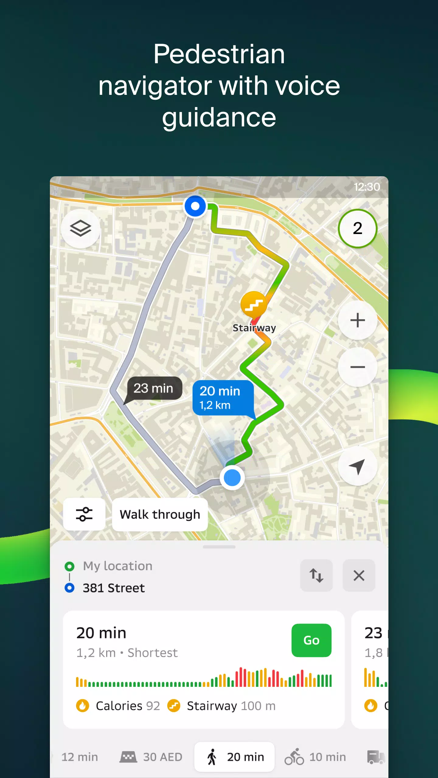
Walking routes
Our pedestrian navigation feature guides you on foot, working in the background with voice guidance to ensure you reach your destination effortlessly.
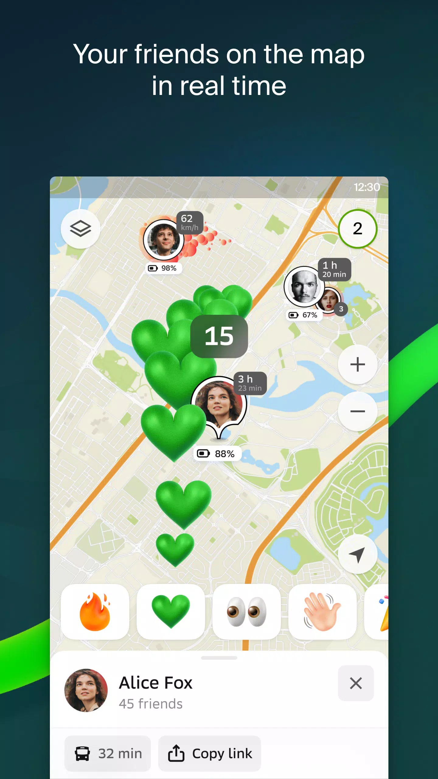
Friends on the map
With 2GIS, you can now track the real-time location of your friends and family on the map. You have full control over who can see your location and who you can see, with customizable visibility settings.
Building entrances
No more wandering around to find the right entrance. 2GIS provides detailed information on how to enter over 2.5 million companies, guiding you directly to the door, whether you're arriving by public transport or car.
Plans of shopping centres
Navigate inside shopping centers with ease. 2GIS maps out everything from shops and cafes to ATMs and restrooms, helping you plan your visit in advance.
A 2GIS beta Notifications companion app for smart watches on Wear OS. This handy tool allows you to navigate routes on foot, by bike, or by public transport directly from your wrist. View the map, receive maneuver hints, and get vibration alerts when approaching a turn or your destination bus stop. The companion app automatically starts when you initiate navigation on your phone and is compatible with Wear OS 3.0 or later.
By using the beta version, you'll be among the first to receive updates as we fix bugs and errors, contributing to the development of a new version of 2GIS that will be used by millions. You can run both the original and beta versions simultaneously and switch between them at any time.
Support: [email protected]
What's New in the Latest Version 6.44.1.559.3
Last updated on Oct 19, 2024
We're thrilled to bring you the latest updates in 2GIS, designed to enhance your navigation and social experience:
— Enjoy more realistic and detailed road visuals on the main map and during route searches. — Introducing Chats for Friends! Now you can communicate directly within the app without leaving the map. — Receive notifications when a friend is nearby, with the option to disable this feature in settings. — Just in time for ski season, we've added ski lift statuses to keep you informed about open slopes. — For public transport routes that include walking, we now calculate the walking portion in steps for better accuracy.