Introducing the definitive HEMAV app, your ultimate tool for monitoring your fields directly from your mobile device. This cutting-edge application harnesses the power of Artificial Intelligence, drone technology, and satellite imagery to provide comprehensive agronomic reports and recommendations through HEMAV LAYERS.
With the HEMAV app, you can easily:
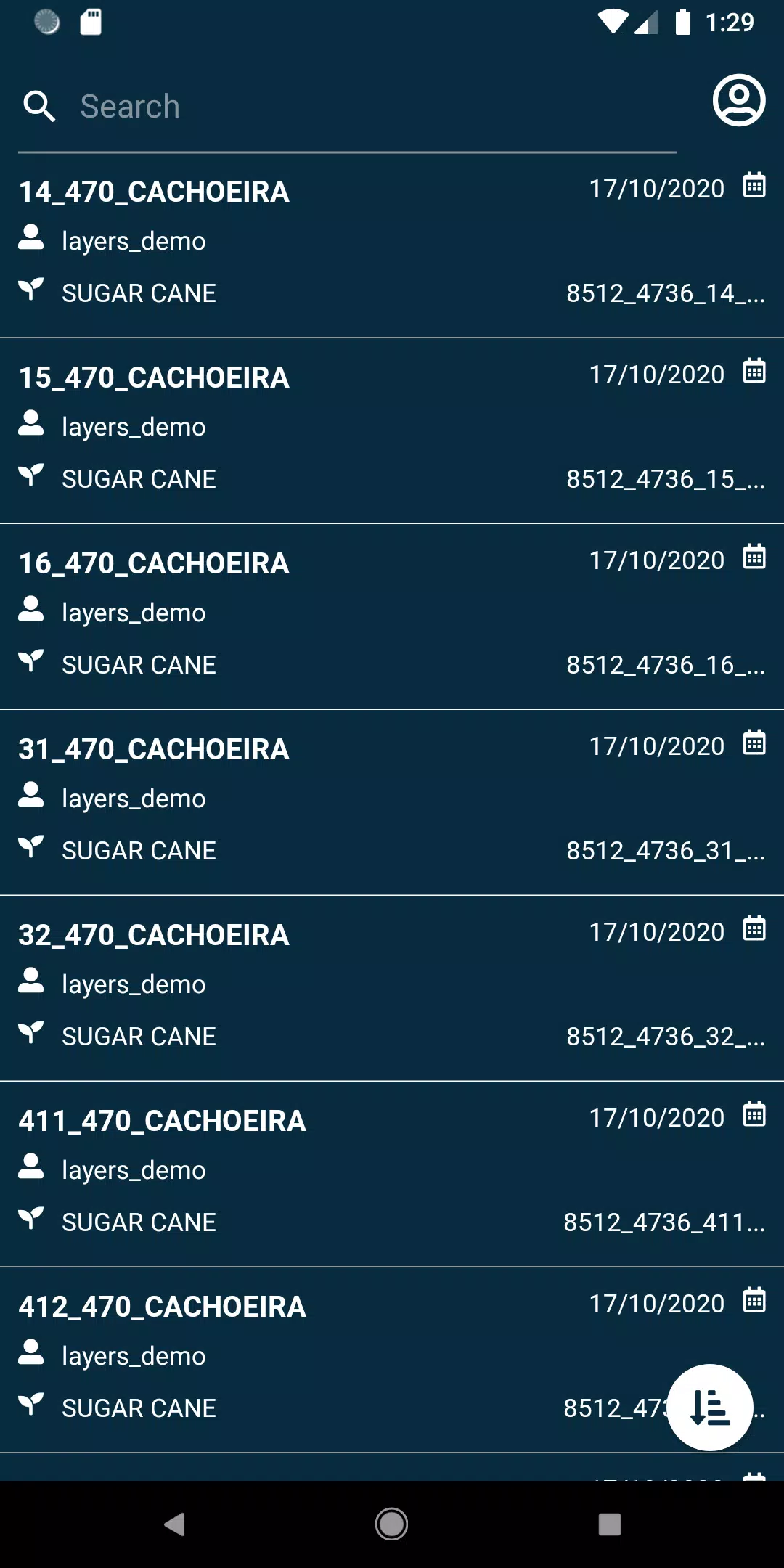
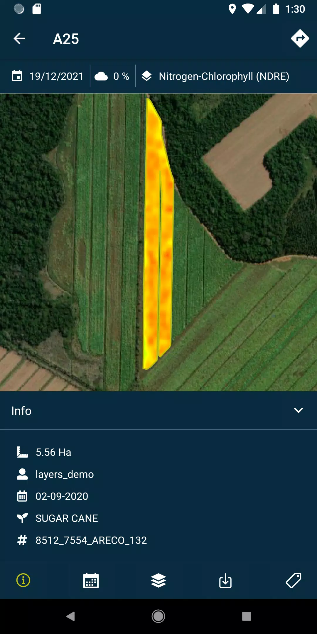
- View your fields with ease and precision.
- Search for specific fields using a variety of filters to suit your needs.
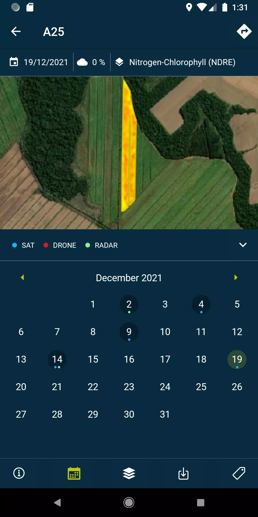
- Access layers of detailed reports and recommendations, as well as PDFs generated from each field's drone or satellite data, both online and offline for maximum flexibility.
- Capture and geolocate field photos, enhancing them with comments for meticulous field management.
- Conduct field surveys and seamlessly integrate them into the system for further processing and analysis.
Please note that to fully leverage the capabilities of this app, a subscription to HEMAV products is required.
About HEMAV Precision Agriculture Service
HEMAV's Precision Agriculture Service utilizes the advanced LAYERS artificial intelligence software to deliver tailored agronomic recommendations. These insights help optimize treatment applications and provide accurate estimates of crop production and quality, revolutionizing the agricultural sector's approach to farming.
What's New in Version 2.8.5
Last updated on Oct 19, 2024
- Bug fixes: Enhancements include resolving issues with pending sample uploads and improving cloud coverage filtering for more accurate data analysis.