Turn your phone into a powerful off-road GPS using offline topo maps!
No advertisements ~ No data sharing & monetization ~ No analytics ~ No third party libraries
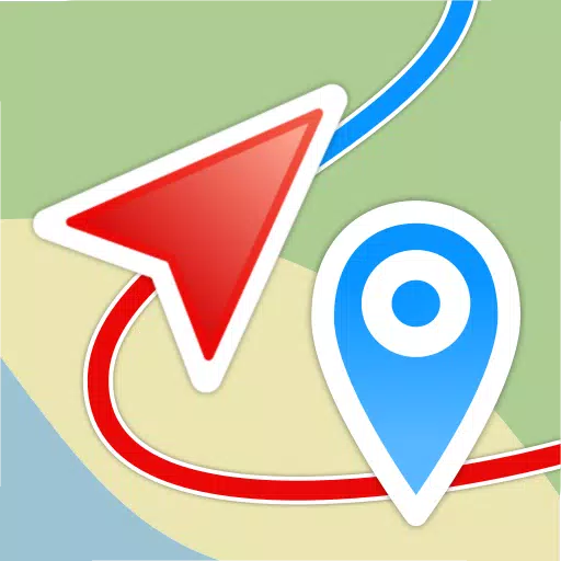
AlpineQuest is the ultimate solution for all your outdoor activities and sports, including hiking, running, trailing, hunting, sailing, geocaching, off-road navigation, and much more.
You can access and store a wide range of online topographic maps locally, which remain accessible even without cell coverage. AlpineQuest also supports numerous on-board file-based raster map formats.
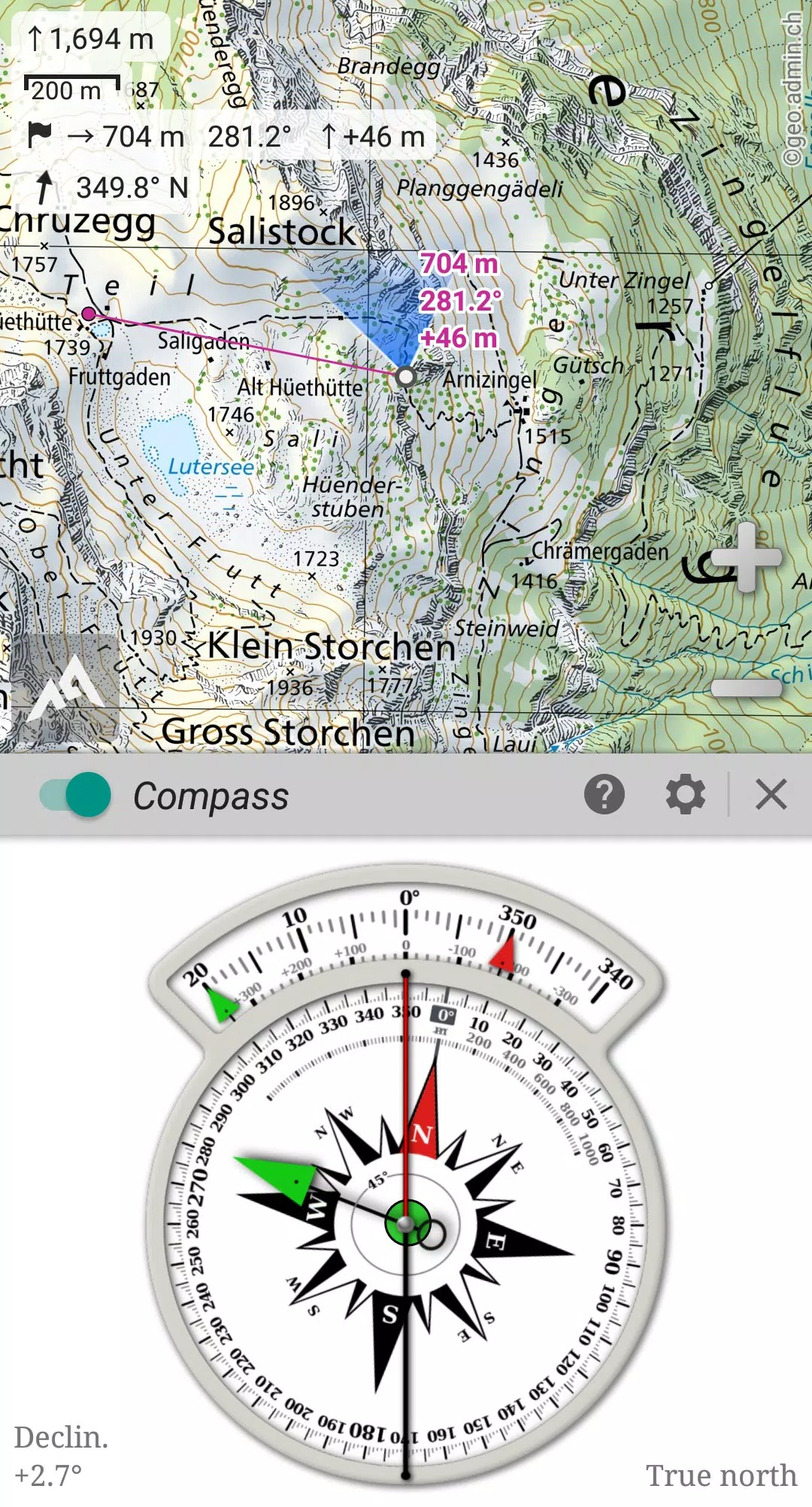
By leveraging your device's GPS and magnetic sensor (with a compass display), getting lost becomes a thing of the past: you are localized in real-time on the map, which can also be oriented to match your viewpoint.
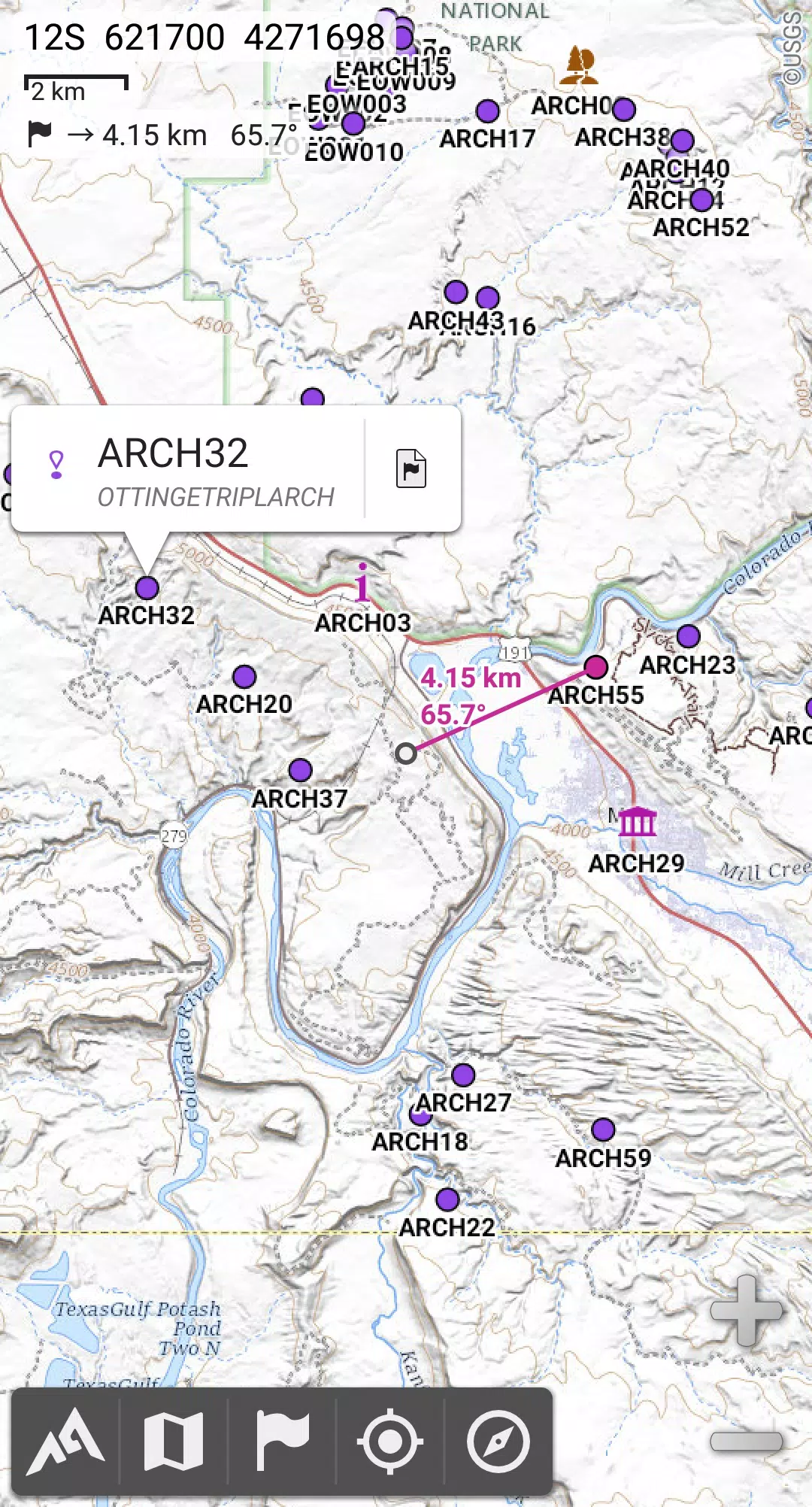
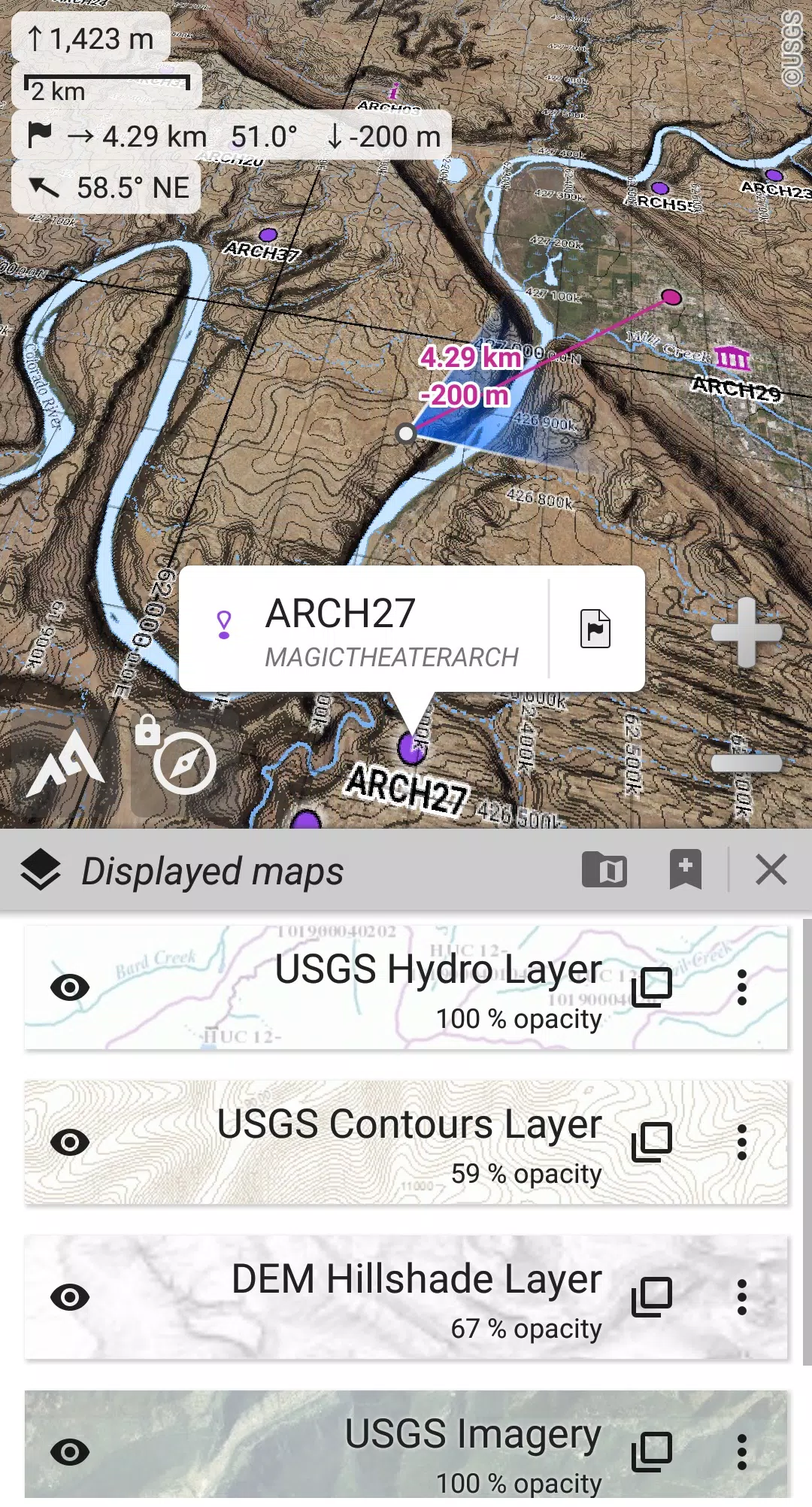
Save and retrieve an unlimited number of placemarks, and share them with your friends. Track your path, access advanced statistics, and view interactive graphics. You'll never wonder about your capabilities again.
AlpineQuest remains fully operational without cell coverage (common in mountainous areas or abroad), making it your perfect companion for deep wilderness exploration.
Don't wait—try this Lite version for free right now!
PLEASE report suggestions and issues on our dedicated forum at https://www.alpinequest.net/forum (no registration required, all questions answered) rather than in comments.
Key features include (for the full version):
★★ Maps ★★
• Built-in online maps (with automatic local storage; road, topo, and satellite maps included) and online layers (road names, hillshade, contours);
• Easily access more online maps and layers from the included community maps list (covering major worldwide and many local topo maps);
• Complete area storage of online maps for offline use;
• On-board offline maps support (raster) including KMZ Overlays, OziExplorer OZFx2, OZFx3 (partial support), calibrated images, GeoTiff, GeoPackage GeoPkg, MbTile, SqliteDB, and TMS zipped tiles (visit our website to get MOBAC, the free map creator);
• QuickChart Memory Map support (.qct maps only, .qc3 maps not compatible);
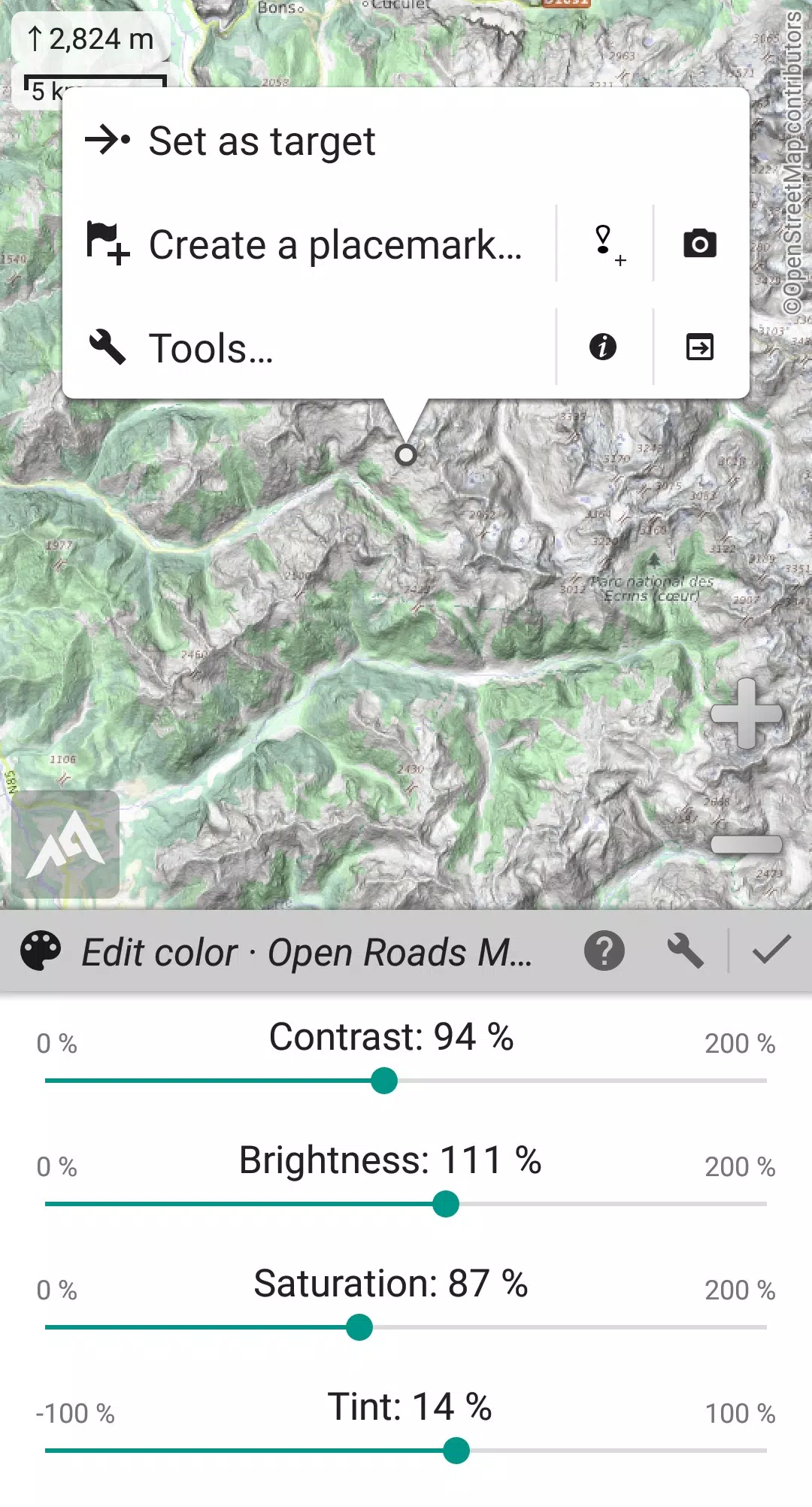
• Built-in image calibration tool to use any scan or picture as a map;
• Digital elevation model on-board storage (1-arcsec SRTM DEM) and support for HGT elevation files (both 1-arcsec and 3-arcsec resolutions) allowing display of terrain, hillshade, and steep slopes;
• Polar maps (Arctic and Antarctic) support;
• Multiple maps in layers display, with per-map opacity/contrast/color/tint/blending control.
★★ Placemarks ★★
• Create, display, save, and restore an unlimited number of items (waypoints, routes, areas, and tracks);
• Import/export GPX files, Google Earth KML/KMZ files, and CSV/TSV files;
• Import ShapeFile SHP/PRJ/DBF, OziExplorer WPT/PLT, GeoJSON, IGC tracks, Geocaching LOC waypoints and export AutoCAD DXF files;
• Save and share online locations with other users using Community Placemarks;
• Access details, advanced statistics, and interactive graphics on various items;
• Time Controller to replay time-tagged tracks.
★★ GNSS Position / Orientation ★★
• On-map geolocation using device GNSS receivers (GPS/Glonass/Galileo/…) or Network;
• Map orientation, compass, and target finder;
• Built-in GNSS/Barometric track recorder (long tracking capable, running in a separate and light process) with battery level and network strength recording;
• Proximity alerts and leave path alerts;
• Barometer support (on compatible devices).
★★ And more ★★
• Metric, imperial, nautical, and hybrid distance units;
• Latitude/Longitude and grid coordinate formats (WGS, UTM, MGRS, USNG, OSGB, SK42, Lambert, QTH, …) with on-map grids display;
• Ability to import hundreds of coordinate formats from https://www.spatialreference.org;
• …
What's New in the Latest Version 2.3.8d
Last updated on Aug 14, 2024
2.3.8b/c/d
• Added a new setting to customize the display style and side of the menu bar;
• Enhanced support for recent Android versions;
• Improved backup and restore functionality;
• Updated default URL for sharing coordinates as text;
• Option to set the application’s “Media” folder as default for placemarks, icons, pictures, and file-based maps;
• Added Croatian and Persian translations;
• Various improvements and bug fixes.