GPS Map Camera: Your Mobile Photography Geotagging Solution
GPS Map Camera APK is transforming mobile photography by cleverly integrating geotagging with a user-friendly interface. Available on Google Play, this Android app enhances photos with precise geographical information, enriching how we document and share travel experiences. Accurate location data embedded in each photo's metadata allows photographers to revisit and relive their journeys with greater detail.
Why Users Love GPS Map Camera
GPS Map Camera's pinpoint location accuracy is a standout feature. Users appreciate its ability to precisely record where each photo was taken, vital for personal memories and professional applications. Real estate agents, explorers, and researchers benefit greatly from this reliable location documentation.
The app's efficiency is another key advantage. Automating location data addition saves time and boosts productivity. Its growing user base and positive app store reviews highlight the ease of sharing detailed memories, transforming simple pictures into rich narratives. GPS Map Camera is a valuable asset for both personal and professional photography.
How GPS Map Camera Works
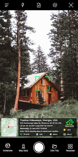
- Download and Install: Download the latest version of GPS Map Camera from Google Play onto your Android device.
- Choose Your Style: Launch the app and select either the "Advance" or "Classic" camera template, customizing the interface to your preference.
- Customize Stamps: Adjust the format of date, time, and other metadata stamps to your liking.

- Fine-tune Camera Settings: Adjust camera settings (grid, aspect ratio, flash, focus) for optimal image quality.
- Automatic Geotagging: The app automatically adds precise GPS data to your photos' metadata.
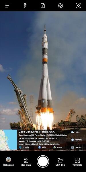
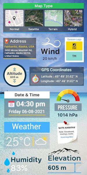
Key Features of GPS Map Camera
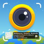
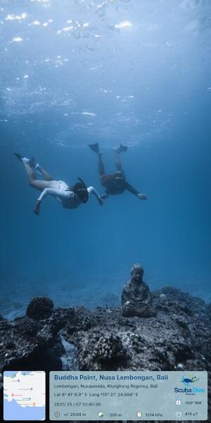
- Precise Geotagging: Embed exact GPS coordinates into your photos' metadata.
- Customizable Map Views: Select from Normal, Satellite, Terrain, or Hybrid map styles.
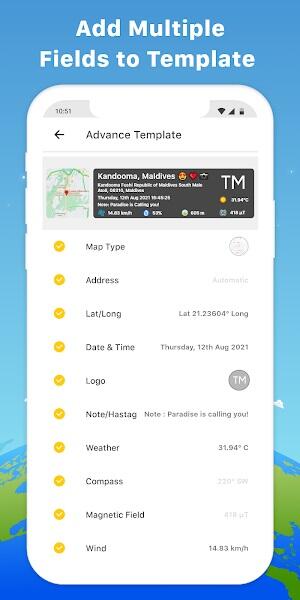
- Address, Lat/Long, Date/Time: Add address, latitude/longitude (DMS or decimal), and customizable date/time stamps.
- Logo, Notes, Hashtags: Include a personal logo, descriptive notes, and relevant hashtags.
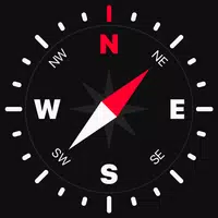
- Weather, Compass, Magnetic Field Data: Capture weather details (temperature, humidity, wind, pressure), compass direction, and magnetic field strength.
- Altitude and Accuracy: Record altitude and ensure accurate geographical data in your photos.
Tips for Optimal Use
- Enable Location Services: Ensure your device's location services are enabled for accurate geotagging.
- Review Privacy Settings: Carefully manage your privacy settings before sharing geotagged photos.
- Calibrate Compass: Regularly calibrate your device's compass for accurate directional data.
- Utilize Hashtags: Use relevant hashtags to increase photo visibility and organization.
- Explore Advanced Settings: Experiment with the app's advanced settings to personalize your experience.
Conclusion
GPS Map Camera is a powerful tool for photography enthusiasts and professionals alike. It seamlessly integrates geographical data into your photos, enriching your visual storytelling. Whether you need detailed documentation or want to share your adventures, download GPS Map Camera APK to elevate your photography. Make every photo both visually stunning and richly informative.